🎉 Up to 70% Off Selected ItemsShop Sale
Oregon SXS Trails 2510 Staging Area to Derrick Caves
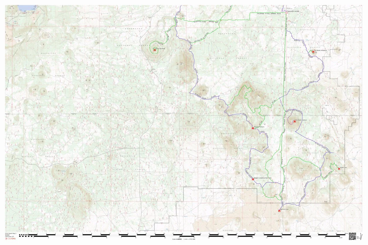
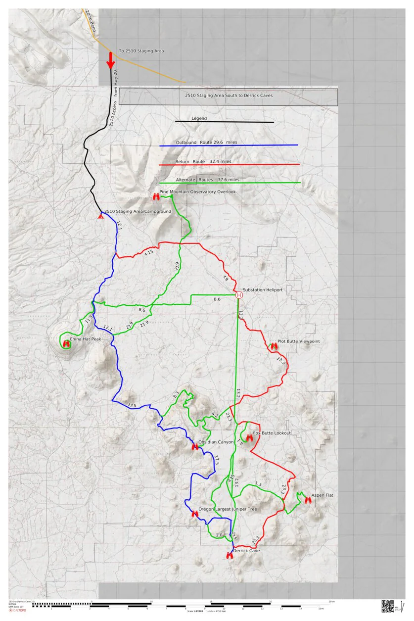
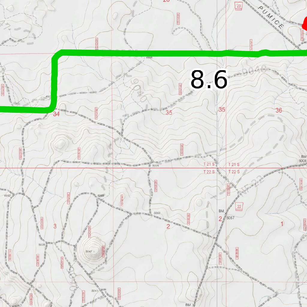
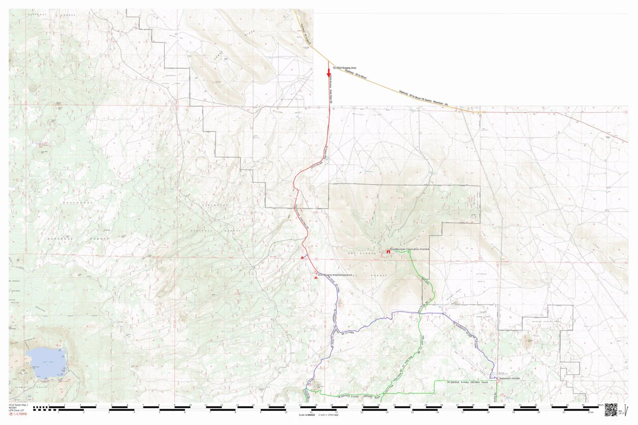
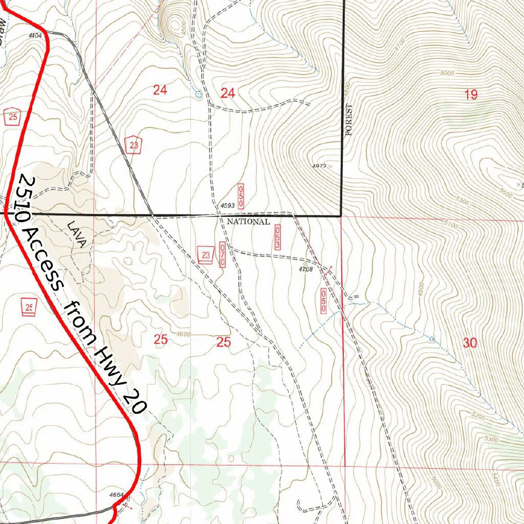
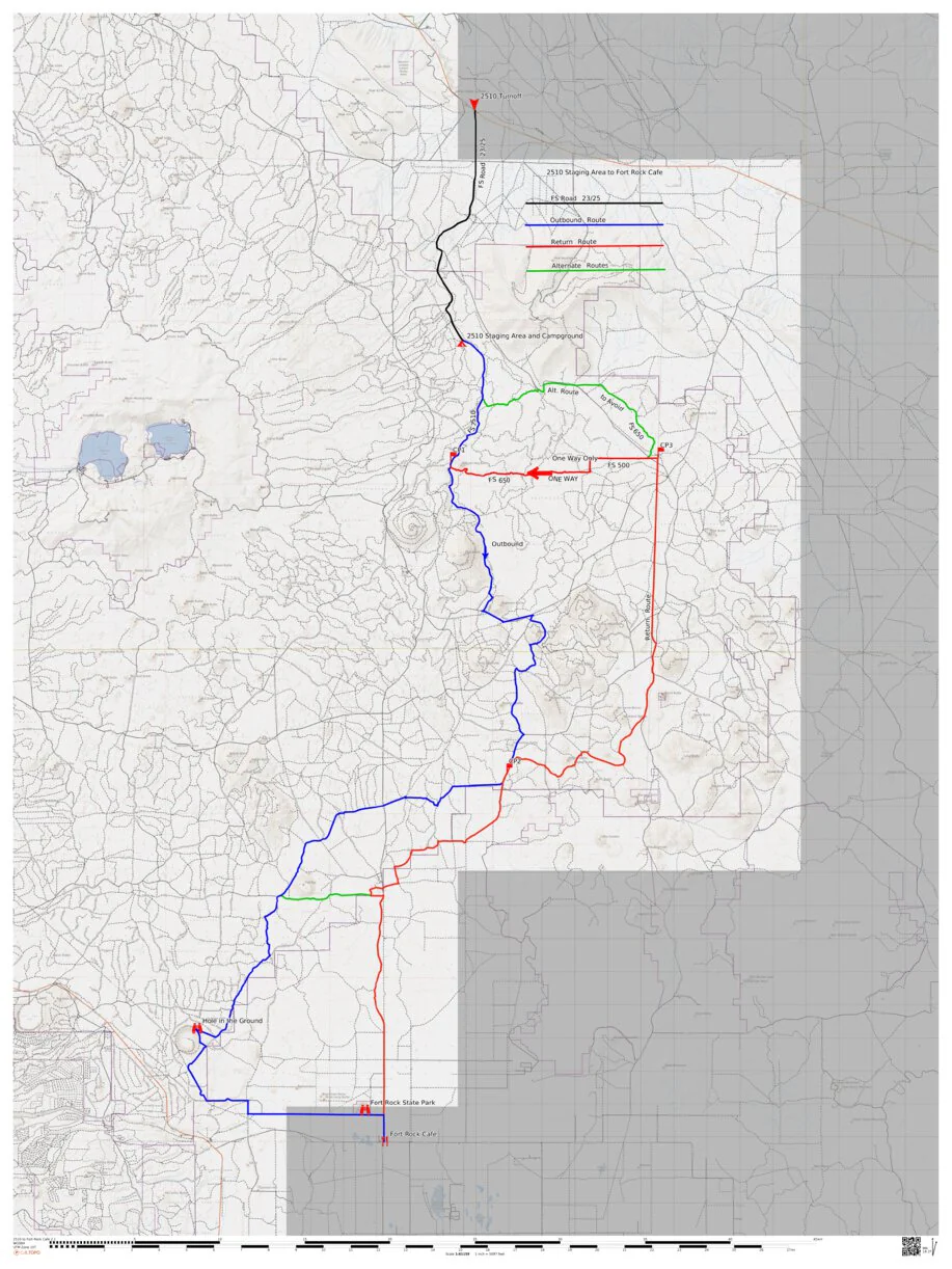
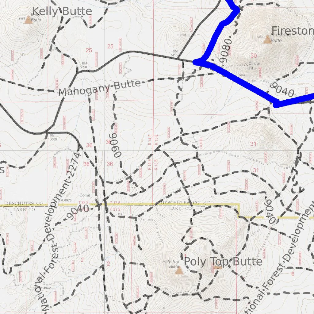
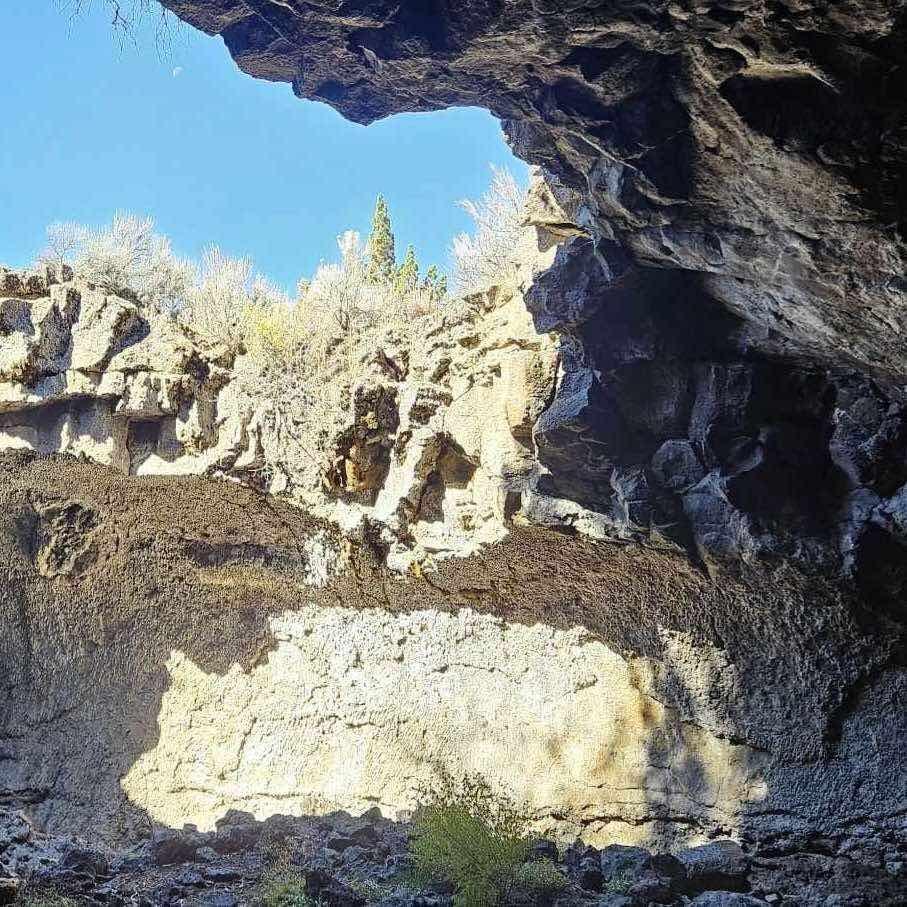
80+ mile loop trail with an additional 40 miles off side trails to explore, 2 map bundle.This is an awesome 66/120 mile Oregon SxS Trail Coalition exclusive map. There is a 66 mile loop trails with 50 miles of side trails and interconnecting trails. You start at 2510 Staging Area/Campground nestled in the pine forest of the Millican Plateau, then head south skirting China Hat Butte, which can ride to the top of for some awesome views. Then wind your thought the lave flows and old growth pine forest to the Oregon's largest juniper, Obsidian Canyon, where time has stood still for millenniums, then ride further south to Derrick Caves, great place to stop lunch and explore the cool cave complex. Then we head north weaving our we along the pine forest of the plateau and wide open expanses of the Millican Valley, to the top of Pine Mountain where you stop and take the short to Pine Mountain Observatory.Winding your down Pine Mountain to desert below and on to the Sand Creek and you the option of returning to 2510 Staging area or exploring the 50+ miles of spur trails the lead to place like Plot Butte where logging companies at the turn of the 1900 century mined the red center for rails line that crisscross the plateau's pine forest.
This map is presented for public use as-is, with no guarantee of accuracy or completeness.
The geographic information contained on this map is not to be construed or used as a "true description”, conditions are ever changing do to weather, changes in and maintenance of roads and trails and government regulations. Always check with the local authorities before proceeding. Every effort has been made to ensure the map accuracy, but errors in mapping or errors in the source documents do occur. Bronco5Group, llc and/or Oregon SxS Trail Coalition assumes no liability for either any errors, omissions, or inaccuracies in the information provided regardless of their cause, or for any decision made, action taken, or action not taken by the user in reliance upon any maps or information provided. These maps are for information purposes only and may not represent actual conditions.
Product Information
Product Information
Shipping & Returns
Shipping & Returns

Oregon SXS Trails 2510 Staging Area to Derrick Caves
Oregon SXS Trails 2510 Staging Area to Derrick Caves
80+ mile loop trail with an additional 40 miles off side trails to explore, 2 map bundle.This is an awesome 66/120 mile Oregon SxS Trail Coalition exclusive map. There is a 66 mile loop trails with 50 miles of side trails and interconnecting trails. You start at 2510 Staging Area/Campground nestled in the pine forest of the Millican Plateau, then head south skirting China Hat Butte, which can ride to the top of for some awesome views. Then wind your thought the lave flows and old growth pine forest to the Oregon's largest juniper, Obsidian Canyon, where time has stood still for millenniums, then ride further south to Derrick Caves, great place to stop lunch and explore the cool cave complex. Then we head north weaving our we along the pine forest of the plateau and wide open expanses of the Millican Valley, to the top of Pine Mountain where you stop and take the short to Pine Mountain Observatory.Winding your down Pine Mountain to desert below and on to the Sand Creek and you the option of returning to 2510 Staging area or exploring the 50+ miles of spur trails the lead to place like Plot Butte where logging companies at the turn of the 1900 century mined the red center for rails line that crisscross the plateau's pine forest.
This map is presented for public use as-is, with no guarantee of accuracy or completeness.
The geographic information contained on this map is not to be construed or used as a "true description”, conditions are ever changing do to weather, changes in and maintenance of roads and trails and government regulations. Always check with the local authorities before proceeding. Every effort has been made to ensure the map accuracy, but errors in mapping or errors in the source documents do occur. Bronco5Group, llc and/or Oregon SxS Trail Coalition assumes no liability for either any errors, omissions, or inaccuracies in the information provided regardless of their cause, or for any decision made, action taken, or action not taken by the user in reliance upon any maps or information provided. These maps are for information purposes only and may not represent actual conditions.
$9.99
Oregon SXS Trails 2510 Staging Area to Derrick Caves—
$9.99
Product Information
Product Information
Shipping & Returns
Shipping & Returns
Description
80+ mile loop trail with an additional 40 miles off side trails to explore, 2 map bundle.This is an awesome 66/120 mile Oregon SxS Trail Coalition exclusive map. There is a 66 mile loop trails with 50 miles of side trails and interconnecting trails. You start at 2510 Staging Area/Campground nestled in the pine forest of the Millican Plateau, then head south skirting China Hat Butte, which can ride to the top of for some awesome views. Then wind your thought the lave flows and old growth pine forest to the Oregon's largest juniper, Obsidian Canyon, where time has stood still for millenniums, then ride further south to Derrick Caves, great place to stop lunch and explore the cool cave complex. Then we head north weaving our we along the pine forest of the plateau and wide open expanses of the Millican Valley, to the top of Pine Mountain where you stop and take the short to Pine Mountain Observatory.Winding your down Pine Mountain to desert below and on to the Sand Creek and you the option of returning to 2510 Staging area or exploring the 50+ miles of spur trails the lead to place like Plot Butte where logging companies at the turn of the 1900 century mined the red center for rails line that crisscross the plateau's pine forest.
This map is presented for public use as-is, with no guarantee of accuracy or completeness.
The geographic information contained on this map is not to be construed or used as a "true description”, conditions are ever changing do to weather, changes in and maintenance of roads and trails and government regulations. Always check with the local authorities before proceeding. Every effort has been made to ensure the map accuracy, but errors in mapping or errors in the source documents do occur. Bronco5Group, llc and/or Oregon SxS Trail Coalition assumes no liability for either any errors, omissions, or inaccuracies in the information provided regardless of their cause, or for any decision made, action taken, or action not taken by the user in reliance upon any maps or information provided. These maps are for information purposes only and may not represent actual conditions.