🎉 Up to 70% Off Selected ItemsShop Sale
Mount Mansfield and the Worcester Range Hiking Trail Map
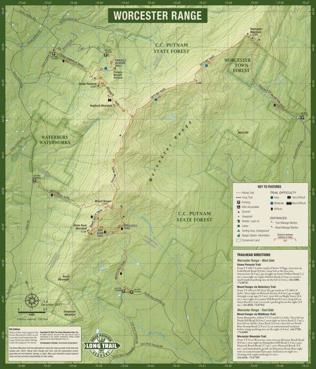
Updated and revised 5th Edition of our full-color waterproof map of the many trails on Mount Mansfield, Vermont’s highest peak. This edition includes the Long Trail relocation through Smugglers Notch, including a new inset of the Barnes Camp Loop. Also included are the hiking trails of the beautiful Worcester Range, including Stowe Pinnacle and Mt. Hunger as well as directions to trailheads and trail difficulty ratings. This new edition includes Mt. Elmore.
Sales of this map support the Green Mountain Club, a member-supported, nonprofit organization which has maintained and protected the Long Trail since 1910.
Product Information
Product Information
Shipping & Returns
Shipping & Returns


Mount Mansfield and the Worcester Range Hiking Trail Map
Mount Mansfield and the Worcester Range Hiking Trail Map
Updated and revised 5th Edition of our full-color waterproof map of the many trails on Mount Mansfield, Vermont’s highest peak. This edition includes the Long Trail relocation through Smugglers Notch, including a new inset of the Barnes Camp Loop. Also included are the hiking trails of the beautiful Worcester Range, including Stowe Pinnacle and Mt. Hunger as well as directions to trailheads and trail difficulty ratings. This new edition includes Mt. Elmore.
Sales of this map support the Green Mountain Club, a member-supported, nonprofit organization which has maintained and protected the Long Trail since 1910.
$6.99
Mount Mansfield and the Worcester Range Hiking Trail Map—
$6.99
Product Information
Product Information
Shipping & Returns
Shipping & Returns
Description
Updated and revised 5th Edition of our full-color waterproof map of the many trails on Mount Mansfield, Vermont’s highest peak. This edition includes the Long Trail relocation through Smugglers Notch, including a new inset of the Barnes Camp Loop. Also included are the hiking trails of the beautiful Worcester Range, including Stowe Pinnacle and Mt. Hunger as well as directions to trailheads and trail difficulty ratings. This new edition includes Mt. Elmore.
Sales of this map support the Green Mountain Club, a member-supported, nonprofit organization which has maintained and protected the Long Trail since 1910.