🎉 Up to 70% Off Selected ItemsShop Sale
Oregon SXS Trails MVUM Santiam Pass
Oregon SxS Trail Coalition is your go to source for compliant SxS maps.
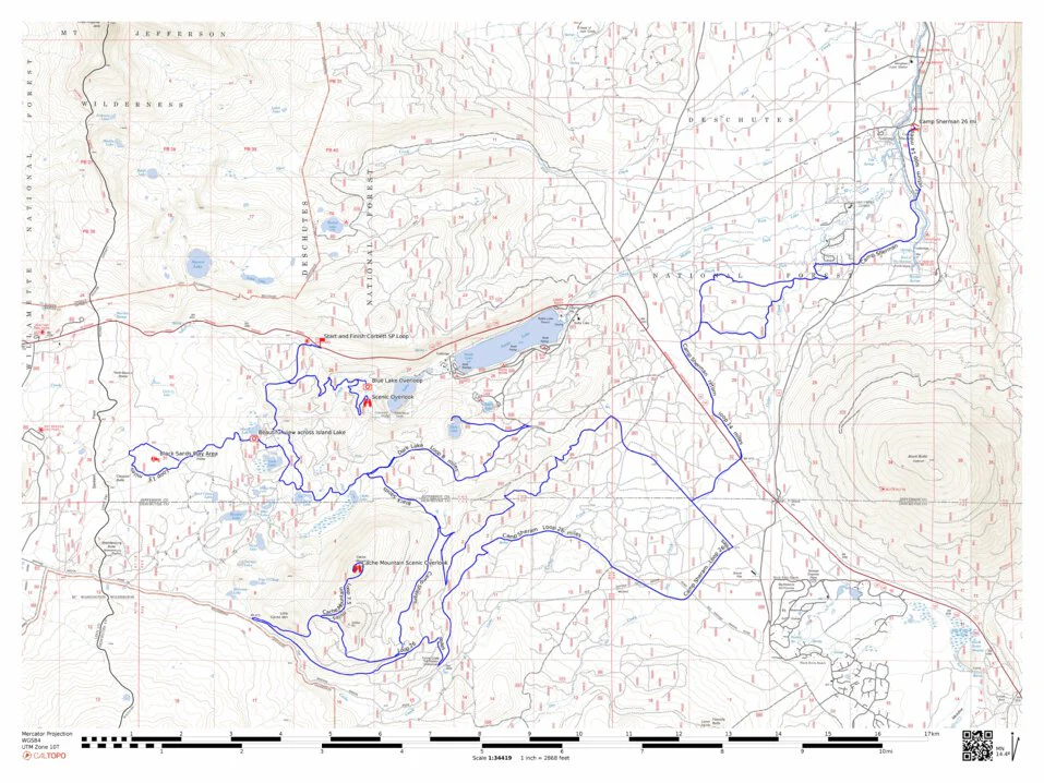
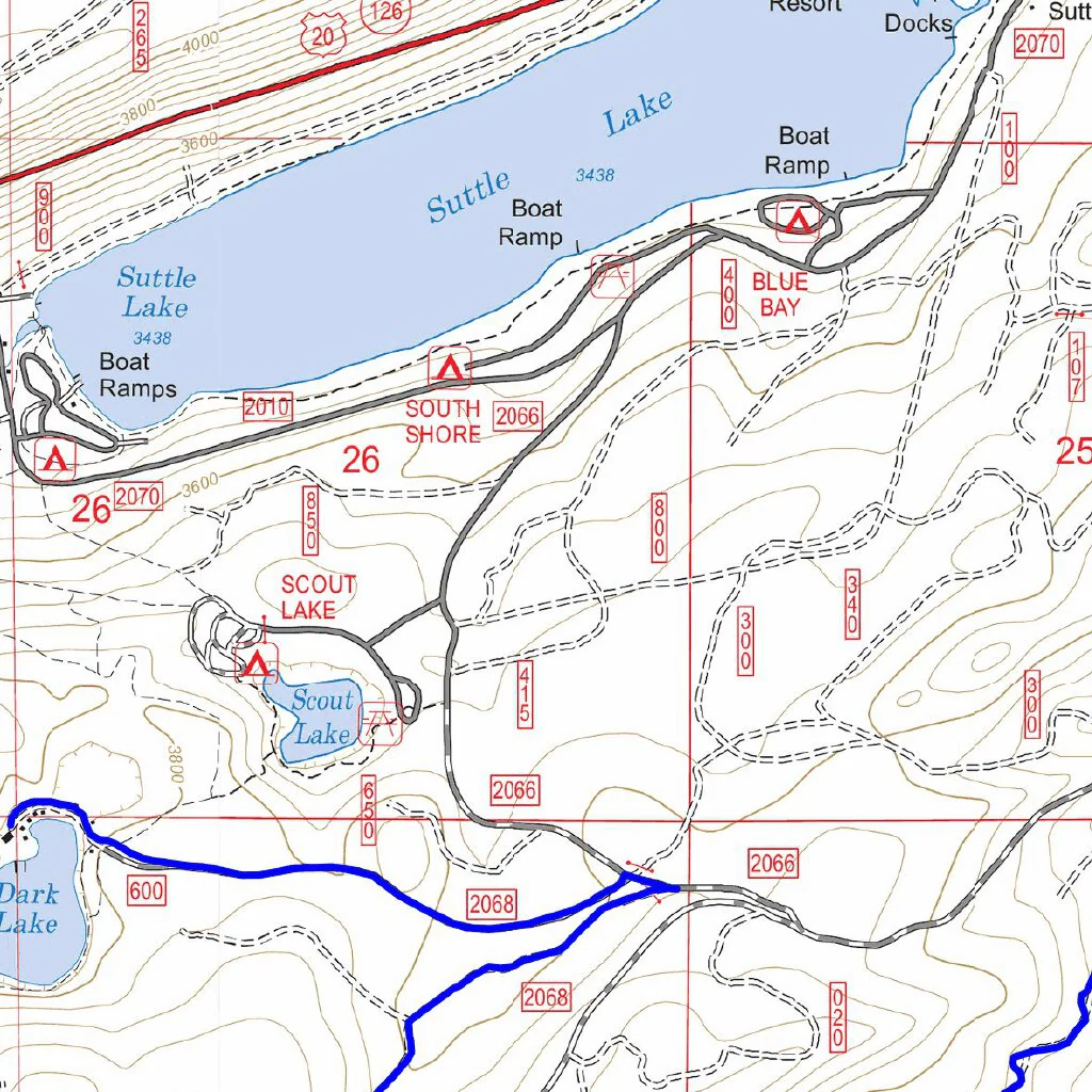
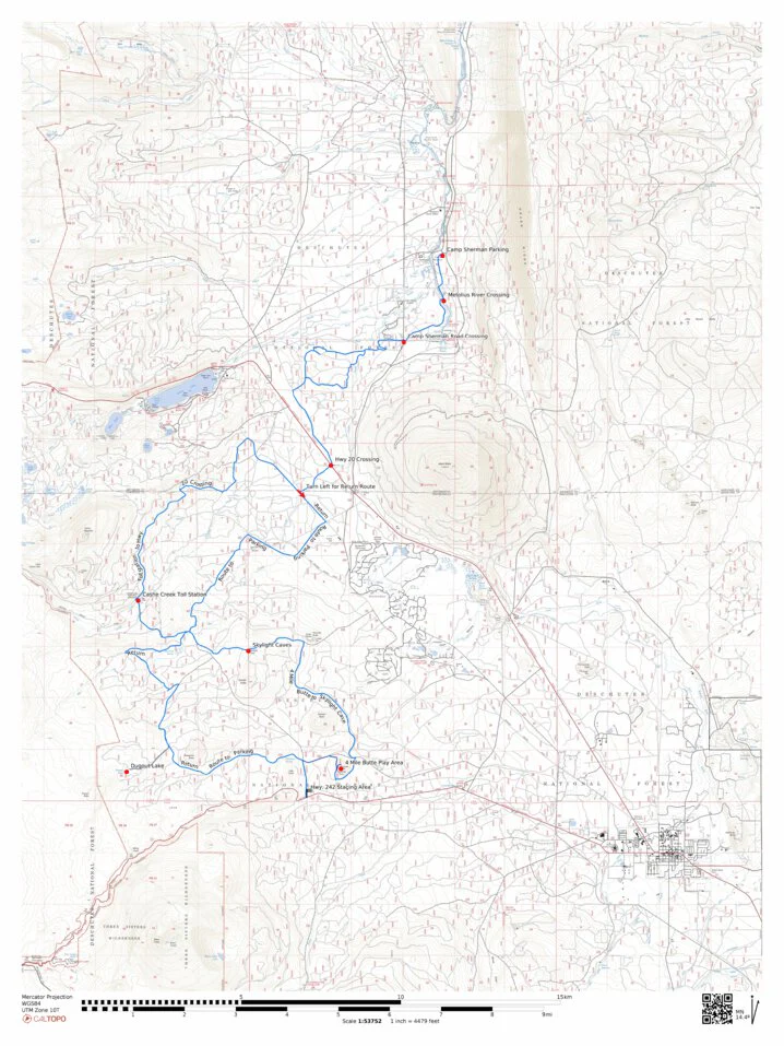
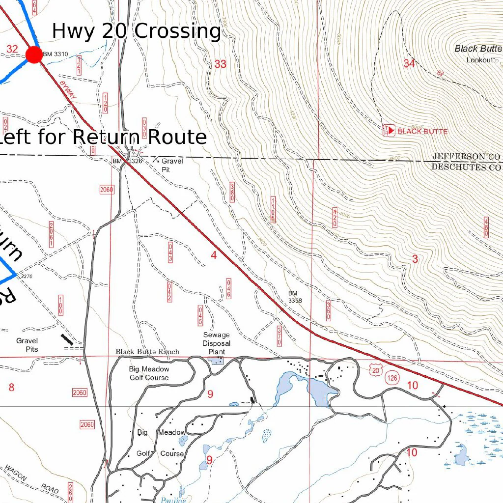
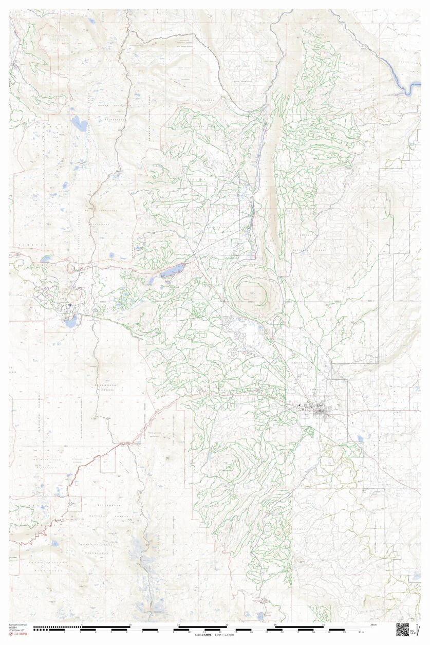
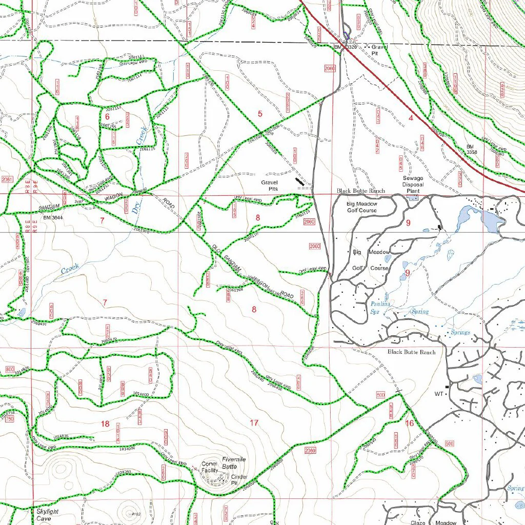
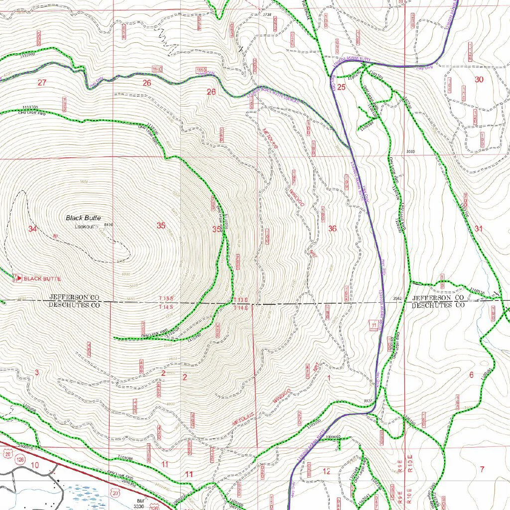
This map is a annotated and color coded intended for the SxS rider in the Santiam Pass Area of Central Oregon, This map is a compilation of USFS Motor Vehicle Use Maps, BLM maps and actual rider trail tracks. This map is a necessary tool for all SxS rider to assure compliance with local regulations, laws and safety..
Use these maps to plan your next adventure with confidence.
Map Legend
Black Dot Trails with green highlights = Year around open trails for SxS
Black Dot Trails with yellow highlights = Seasonal Closure trails for SxS
Blue Trails = Class 1 and 3 OHV trails closed to SxS use
Red solid Roads = Closed to SxS use
This map is presented for public use as-is, with no guarantee of accuracy or completeness. The geographic information contained on this site is not to be construed or used as a "true description". Every effort has been made to ensure the map accuracy, but errors in mapping or errors in the source documents do occur. Oregon SxS Trail Coalition assumes no liability for either any errors, omissions, or inaccuracies in the information provided regardless of their cause, or for any decision made, action taken, or action not taken by the user in reliance upon any maps or information provided. These maps are for information purposes only and may not represent actual conditions
Product Information
Product Information
Shipping & Returns
Shipping & Returns
Oregon SXS Trails MVUM Santiam Pass
Oregon SXS Trails MVUM Santiam Pass
Oregon SxS Trail Coalition is your go to source for compliant SxS maps.
This map is a annotated and color coded intended for the SxS rider in the Santiam Pass Area of Central Oregon, This map is a compilation of USFS Motor Vehicle Use Maps, BLM maps and actual rider trail tracks. This map is a necessary tool for all SxS rider to assure compliance with local regulations, laws and safety..
Use these maps to plan your next adventure with confidence.
Map Legend
Black Dot Trails with green highlights = Year around open trails for SxS
Black Dot Trails with yellow highlights = Seasonal Closure trails for SxS
Blue Trails = Class 1 and 3 OHV trails closed to SxS use
Red solid Roads = Closed to SxS use
This map is presented for public use as-is, with no guarantee of accuracy or completeness. The geographic information contained on this site is not to be construed or used as a "true description". Every effort has been made to ensure the map accuracy, but errors in mapping or errors in the source documents do occur. Oregon SxS Trail Coalition assumes no liability for either any errors, omissions, or inaccuracies in the information provided regardless of their cause, or for any decision made, action taken, or action not taken by the user in reliance upon any maps or information provided. These maps are for information purposes only and may not represent actual conditions
$4.99
Oregon SXS Trails MVUM Santiam Pass—
$4.99
Product Information
Product Information
Shipping & Returns
Shipping & Returns
Description
Oregon SxS Trail Coalition is your go to source for compliant SxS maps.
This map is a annotated and color coded intended for the SxS rider in the Santiam Pass Area of Central Oregon, This map is a compilation of USFS Motor Vehicle Use Maps, BLM maps and actual rider trail tracks. This map is a necessary tool for all SxS rider to assure compliance with local regulations, laws and safety..
Use these maps to plan your next adventure with confidence.
Map Legend
Black Dot Trails with green highlights = Year around open trails for SxS
Black Dot Trails with yellow highlights = Seasonal Closure trails for SxS
Blue Trails = Class 1 and 3 OHV trails closed to SxS use
Red solid Roads = Closed to SxS use
This map is presented for public use as-is, with no guarantee of accuracy or completeness. The geographic information contained on this site is not to be construed or used as a "true description". Every effort has been made to ensure the map accuracy, but errors in mapping or errors in the source documents do occur. Oregon SxS Trail Coalition assumes no liability for either any errors, omissions, or inaccuracies in the information provided regardless of their cause, or for any decision made, action taken, or action not taken by the user in reliance upon any maps or information provided. These maps are for information purposes only and may not represent actual conditions